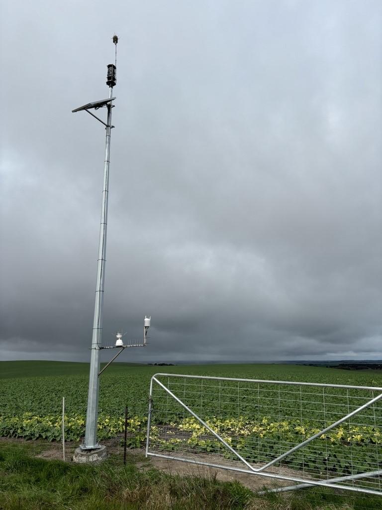
Anthony Evans represents the middle rung in a triple-generation farming set-up, which comprises his father (88), himself (53) and his son, who turns 23 later this year.
The Evans property has become proud host to one of the 25 multi-sensor weather station units which make up the Ararat Rural Information Network (ARIN), which is just a few weeks away from public access.
Anthony farms sheep and a large cereal crop across 2300 acres just outside of Willaura, with another 1200 acress leased a few kilometres south. The region’s weather – and its adherence to, or detour from, the Bureau of Meterology’s bulletins – plays a part in just about every decision Anthony makes about his business.
This is why he was so keen to attend an information night in Willaura in early 2023, to discover how he could become part of the weather station project at the heart of the ARIN network.
“The weather stations are spread out all over [the municipality],” Anthony explains. “Ours has no trees around it to obstruct its readings, and it’s on the fenceline, so there’s access to it all the time.”
The data Anthony’s station collects on wind speed, wind direction, wind gusting, barometric pressure, rainfall, thermal imaging and more - all measured continuously, and reported every minute – provides invaluable guidance for on-farm choices.
“It’s very handy for spraying,” he says. “Quite often, just five to ten kilometres away, you’ll have very different readings. All these things, they count towards decisions you make.”
And what did he use to gather this kind of accurate information before ARIN?
“Nothing!” he laughs. “Well, we’d use [the Bureau of Meterology], but as you know, they can be pretty… not accurate.” Anthony would also occasionally use a hand-held weather meter, but it had its own drawbacks and wasn’t an ideal tool.
The weather station’s real-time readings also include soil moisture, collected via a probe which extends down nearly a metre into the soil.
“That will give us guidance for fertiliser – whether to fertilise at that time or not – and sowing times, to a certain degree,” Anthony explains. “This is the ‘guinea pig’ probe. Neighbours could also have probes, but you’d need to contact them to get their readings.”
The problem of sharing privately-collected weather information is something Anthony thought about three years ago, when he was first considering installing a private weather station on his property. But as part of the ARIN network, now he can consult not just his own readings but those of the 24 other stations within the station network.
“All the neighbours will be able to log into it too,” Anthony says. “Anyone can log in, to all weather stations around the municipality.”
Read more about how the ARIN project was funded and launched on Engage Ararat.
Image: The weather station sensor on the Evans property, photographed by Anthony Evans.

